Advanced Search
Topographia Galliae...Königreich Franckreich [Part 1]
Author: Martin Zeiller (German, 1589–1661)
Illustrated by: Matthäus Merian I (German, 1593–1650)
After: Jan Peeters, I (Netherlandish, 1624–before 1680)
Printer: Kaspar Merian (German, 1627–1686)
Illustrated by: Matthäus Merian I (German, 1593–1650)
After: Jan Peeters, I (Netherlandish, 1624–before 1680)
Printer: Kaspar Merian (German, 1627–1686)
1655
Place of Publication: Frankfurt, Germany
Medium/Technique
Illustrated book with engraved title and 114 engravings
Dimensions
Overall: 32.8 x 21.2 x 5.5 cm (12 15/16 x 8 3/8 x 2 3/16 in.)
Credit Line
Gift of Mrs. Horatio Greenough Curtis
Accession Number25.708
NOT ON VIEW
CollectionsEurope, Prints and Drawings
ClassificationsIllustrated books
Frankfurt: Kaspar Merian, 1655
Catalogue Raisonné
Brunet V, 1530; VD17 3:003575F; Berlin 1924.17 (Gallia, pt. 1 only); Nat. Gallery, Millard Coll., v. 3, cat. 84
Description(Frankfurt: Kaspar Merian, 1655) Folio; 55 leaves,plus plates [lacking letterpress title and dedication]; contemporary vellum, dark blue cloth box.
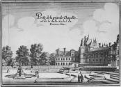
Maps, topographic views, and views of individual buildings and sites in the Ile de France, especially Paris.
First edition; part of a vast project on European topography. That for France took 13 parts, of which this is the first, concentrating on Paris and the Ile de France. The last part was published in 1661. The MFA owns the first edition of Topographia Alsatiae, 1644 [04/100].
Note on the illustrations: only some carry the signature of Jan Peeters, primarily town views toward the end of the volume.
ProvenanceHoratio Greenough Curtis; his widow, by whom given to the MFA, April 1925.

![Topographia Galliae...Königreich Franckreich [Part 1]](/internal/media/dispatcher/902616/preview;jsessionid=464E96288ED3A7F554D8F266A87A8477)

